Showing posts with label Oregon. Show all posts

Monday, June 9, 2014

Heirloom Roses


It’s June. It’s Portland. And it’s all about roses. For years, the Rose City has celebrated its eponymous flower with a festival, parades, royal court, and the obligatory visit to its most famous showplace, the International Rose Test Garden in Washington Park. If you want to smell the roses without the crowds, head south about 25 miles to the Willamette Valley for a visit to Heirloom Roses.
Here, spread out over five acres of themed gardens, are thousands of roses in all colors, shapes, and sizes. Visitors are free to wander through the grounds admiring the Climbers, the Miniatures, the Hybrid Teas, or sit on a bench in the shade and enjoy the fragrance and hues.
In the Sales Cottage, a wide variety of plants are available along with rose-specific gardening tools, books, and supplies. The gardens are open year round with roses in bloom from May to October, but June is certainly the peak time.  Take a look!


Monday, May 26, 2014

The Many Murals of Estacada

For some 20,000 years, humankind has been attracted to the bare wall as a canvas for artistic expression. From the caves of Lascaux in southwestern France where primitive men drew the animals of their known world to the satirical stencilings of British graffiti artist, Banksey, murals have been a popular art form and means of communication. They are considered one of the oldest artistic endeavors and even here, in the Pacific Northwest, native tribes along the Columbia River left art work in the form of petroglyphs that are still visible today after hundreds of years.
The outdoor wall mural has been chosen by a number of small Northwest towns as a strategy for economic development and beautification with Chemainus, British Columbia, as the most noted example. A dying logging community on Vancouver Island, it transformed itself into a huge outdoor art gallery drawing tourists from around the world.  Taking a cue from its northern neighbor, the town of Vale in Eastern Oregon painted 30 empty walls with tales from the Oregon Trail as a way to attract travelers along Interstate 84. Toppenish, Wash., Cottage Grove, Silverton, Springfield, and The Dalles have all dressed up their towns with colorful murals.

A good example closer to Portland, is the town of Estacada, about 35 miles southeast along the banks of the Clackamas River, at the edge of Mt. Hood National Forest. Rather young by Oregon standards, the community was founded in 1905 after a rail line was built to support construction of a series of hydroelectric dams upstream along the Clackamas River. The railroad also serviced a thriving logging and milling industry and the owners of the line (Oregon Water Power and Railway Company) built a grand hotel and park to lure Portland tourists. On weekends, city dwellers rode the electric streetcar out to Estacada or further along the route to Cazadero for an enjoyable day of picnics, fishing, and chicken dinners at the Hotel Estacada.

Over time, the dams were completed, the logging industry faded, the hotel burned down, and the town began to fade as the local economy stagnated. In 1992, several local, professional artists joined together to create the Artback Artists’ Cooperative, and painted the first mural in Estacada. It was so well received by the community that a tradition was born of painting a new mural on the fourth weekend in July during the city’s Summer Celebration. This mural-in-a-weekend program has created a total of 18 murals scattered about town. Because sun and exposure to weather elements have faded many of the older murals, the artists have switched to an alternating program of restoring a mural one year and creating a new one the next year.

Most of the murals celebrate some aspect of the area’s history and recreational opportunities including Native American life, logging, the Barlow Road, train travel, fishing, quilting, and mushroom foraging. On the wall of Wong’s King Chinese restaurant is a colorful mural dedicated to a surprising, local crop called ginseng. In the early 1900s, this medicinal herb was an important element in the local economy, and was shipped to China where it is highly revered for its restorative properties. But, global events including the Depression, World War II, and the rise of Communism in China brought an end to the industry.

To visit the murals, pick up a Walking Tour map available at the Chamber of Commerce office in City Hall on Main Street. Most of murals are located in a compact area of about six city blocks and their color and size make them easy to spot. This year’s Summer Celebration falls on the weekend of July 26 and 27 and provides an opportunity to view a mural in the making. The theme of the 2014 mural is the Hamatsa dance of the Kwakwaka’waka people of Vancouver Island, B.C. and will complete a trilogy of native-themed murals designed by John Freese on the walls of the Harvest Market on Broadway.


In addition to the mural-in-a-weekend project, the festival includes music, arts and crafts, food and entertainment. Unfortunately, the trolley no longer brings city dwellers out to Estacada; you’ll have to drive.

Monday, March 3, 2014

Lasting Legacy of the CCC


At the Forest History Center on State Street in Salem there stands a life-size statue of a hunky, shirtless, young man leaning on a shovel. 
CCC Worker Statue
He is posed in front of a wooden, green building with a pair of gables and twin dormer windows. Their connection is a federal program initiated by Franklin D. Roosevelt shortly after his inauguration to provide jobs for the nation’s growing number of unemployed young men.

Known as the Civilian Conservation Corps, or CCC, it operated between 1933 and 1942, and was one of the most successful and popular New Deal programs.  Oregon was an active participant with over 60 camps scattered around the state. The men built roads, bridges, trails, campgrounds, fought forest fires, and planted trees. In exchange for their labor, they received education, job training, food and shelter (three hots and a cot) and the grand sum of $30 a month. They could keep $5 with the other $25 sent home to their families.  Even though eighty years have passed and many CCC efforts are long gone, about one-third of the permanent projects in Oregon remain and can still be enjoyed in forests and parks around the state.
Forest History Center, Salem

The Forest History Center is a good place to begin. The building was constructed by the CCC in 1936 to house their headquarters, and was moved to its present location from the east side of Mill Creek in 2001. Today, a section of the museum is dedicated to the CCC program and features camp photos, a wall map with site locations, and miscellaneous memorabilia donated by alumni. The CCC Worker Memorial Statue in front was dedicated in 2002.

Silver Falls Lodge
One of the program’s permanent projects is a short distance east of Salem at Silver Falls State Park. The CCC was responsible for constructing much of the infrastructure seen in the South Falls Day Use Area including rocks walls, bridges, stairs and the rustic South Falls Lodge. The lodge and surrounding ten acres are listed in the National Register of Historic Places. In addition, the CCC developed the park’s popular Trail of the Ten Falls.

West Shelter, Cape Perpetua
The Oregon Coast hosted several CCC camps, and remnants of Camp Cape Creek remain visible on the site of the Cape Perpetua Visitor Center, two miles south of Yachats.  Workers here built the campground and network of trails, but their most noted accomplishment was the West Shelter observation point at the top of the headland. Built of rocks, this sturdy structure has survived years of Pacific storms and even served as a coastal watch station during World War II.  Today’s visitors are more interested in spotting migrating whales than enemy boats or planes.

Mt. Hood National Forest, east of Portland, also saw many CCC projects. Camp Zigzag on Highway 26, was the longest running camp in the Northwest, and its workers built the Zigzag Ranger Station on the south side of the road. This compound consisting of various outbuildings is constructed in the Cascadian Rustic style using natural materials such as wood shingles, weatherboard, and native stone.  A similar, but more off-the-beaten-path ranger station can be visited on Forest Road 42, about 20 miles southeast of Government Camp. Here, at the Clackamas Lake Historic Ranger Station, are eleven buildings including a small visitor center. The ranger’s residence was built by the CCC in 1933 and is available for rental during the summer months.

Mt. Hood’s Timberline Lodge, probably the best known Depression-era project in Oregon, was constructed by the WPA, but the CCC worked on the lodge’s terracing, stonework, and landscaping. They built the Timberline Trail encircling Mt. Hood and worked on a variety of other projects in the area including Cloud Cap Inn and several campgrounds.

Malheur Nat'l Wildlife Visitor Center
In other parts of the state you’ll find evidence of the CCC at Crater Lake’s Rim Road and Rim Village, the rock work at Oregon Cave’s Chateau, the Visitor Center and Museum at the Malheur Wildlife Refuge, Jessie Honeymoon State Park near Florence, and the Dee Wright Observatory at the summit of McKenzie Pass.

The CCC program lasted only nine years.  By 1942, the country was gearing up for WWII and young men were leaving to join the army.  However, their hard work through those difficult Depression years left a significant contribution and lasting legacy to Oregon’s public lands.


Saturday, June 22, 2013

Bandon-by-the-Sea


When Irish immigrant George Bennett arrived at the mouth of the Coquille River on the southern Oregon Coast he brought the name of his Irish hometown, Bandon, to the new settlement.  Additionally, he brought an Irish shrub called gorse (ulex europaeus) and planted it as a fence hedge surrounding his property.
Gorse is plentiful along Oregon's South Coast
This ornamental evergreen with its bright yellow blossoms soon infested the area, spreading along the sand dunes and throughout the town. Unfortunately, the high oil content of its foliage made the plant extremely flammable, a factor that would change Bandon forever.

In 1936, the town was a thriving community: a logging and fishing center, home to cows and cranberries, and the busiest port between San Francisco and Portland. On a warm and dry September evening, a shift in winds brought a nearby forest fire closer to town. When it reached the gorse, the fire exploded into an inferno completely destroying the entire commercial district in a short time and leaving 1800 inhabitants homeless.

Coquille River Lighthouse
Like the mythological Phoenix, the town rose from the ashes and rebuilt itself. Today, Bandon-by-the-Sea, as it is known in tourism parlance, is a favorite destination on the Oregon Coast. The Bandon Dunes Golf Resort, a complex of five courses just north of town, attracts players from all over the world. Set on a bluff overlooking the ocean and dunes, it consistently appears on any list of top ten golf courses and compares favorably to some of the best in Scotland and Ireland.

There is more than golf to keep visitors coming back. Like any coastal community, the ocean is the big draw, and the setting in Bandon couldn’t be more spectacular. Wide, sandy beaches are easily accessible and offer a plethora of driftwood, agates, jasper, and petrified wood. Offshore are wildly sculpted sea stacks and monolithic rock formations providing sanctuary for a wide variety of sea birds. Where the Coquille River meets the ocean, an octagonal lighthouse with a tall round tower stands guard over the perilous bar. Built in 1896, it was the last lighthouse constructed along the Oregon Coast. It was decommissioned in 1939, but volunteers and lighthouse enthusiasts keep this landmark maintained and opened to the public during summer months.

Wooden, welcome arches lure travelers along Highway 101 to detour into Bandon’s Old Town. This compact downtown offers a variety of shops, galleries, restaurants, an excellent history museum, independent bookstore, and plenty of free parking. A walkable waterfront lines one of the two main streets allowing close access to fishing boats, charters, and fresh seafood. Bandon Fish
Market makes a tasty stop for fish and chips followed by a dessert visit to Cranberry Sweets located across the street. This local institution features all sorts of cranberry candy goodies, and they are most generous with their free samples.

Cranberries are an important business here and Bandon boasts of being “The Cranberry Capital of Oregon.” The acidic, sandy soil and mild climate make it a perfect place for cranberries and there are nearly 1600 acres under cultivation. Bogs can be seen along Highway 101 north and south of town with most of these berries destined for bottles of Ocean Spray juice.  On the second full weekend in September, the town celebrates this crop with a four-day cranberry festival.

Bandon Fish Market
Bandon is also known for its dairy industry and for years, Bandon Cheese was a popular stop for visitors traveling the coast. After the business was sold to Tillamook Cheese, the creamery and retail store closed, but a new cheese factory opened this spring. Face Rock Creamery will be offering a variety of their locally made cheddars as well as squeaky cheese curds and Umpqua ice cream cones.

The town of Bandon is bookended by two state parks. To the north is Bullards Beach State Park with a large campground, sandy beach, and access to the lighthouse. To the south, is a string of state owned lands including Face Rock Scenic Viewpoint and Bandon Natural Area offering beach access and close-up viewing of the rock formations offshore. Beach Loop Road parallels the ocean, connecting all these scenic vistas. No trip to Bandon would be complete without a stop at 11th Avenue and Beach Loop Road at Coquille Point for a calendar view of the very best of the Oregon Coast.

From Coquille Point

Sunday, May 19, 2013

Memorial Day Monuments


For many, Memorial Day signals the beginning of summer, the kickoff of white shoe season, the Indy 500, Oregon winery open-house weekend, and yet another federal three-day holiday. However, it is important to reflect on the history and significance of this day that honors the men and women in the military services who have made the ultimate sacrifice for their country.
Soldier's Monument, Lone Fir Cemetery
Originally known as Decoration Day, the holiday’s beginnings are a little fuzzy depending on a Yankee or Confederate perspective. At the end of the Civil War, in May of 1868, Commander of the Grand Army of the Republic, General John Logan, officially proclaimed May 30 a day of commemoration, and flowers were placed on the graves of the 20,000 Union and Confederate soldiers buried in Arlington National Cemetery. Southern states refused to follow the May 30 tradition and had their own Confederate Memorial Days. By the end of World War I, the observance was expanded to include fallen soldiers of all wars and in 1971, it became officially known as Memorial Day and observed on the last Monday in the month of May.
The Portland area features a number of war and veteran memorials, many of them tucked out of the way, others in public areas but largely ignored. The oldest monument honoring the war dead is in Lone Fir Cemetery on 26th SE, between Stark and Morrison. The Soldier’s Monument, near the center of the cemetery, was dedicated in 1903 to the veterans of the Civil War, Mexican, Spanish, and Indian Wars and is typical of that era, a bronze soldier with flag standing on top a stone pediment. The cemetery, dating back to 1846, is final home to over 200 Civil War veterans.

Lownsdale Square, Portland
Another pedestal-soldier style monument is located in downtown Portland in Lownsdale Square at the intersection of SW 4th and Main. Unveiled in 1906, Soldiers Monument is dedicated to Oregonians killed in the Spanish American War. The tall, granite obelisk is topped by a bronze replica of an infantryman of the Second Oregon U.S. Volunteer Infantry. At the base of the statue are two Howitzers used at Fort Sumter at the start of the Civil War.  One points north; the other south.

Across the Willamette River, in the Rose Quarter, stands the Veterans Memorial Coliseum. This indoor arena with its unusual glass design was built in 1960 and dedicated in 1961 to the veterans of World Wars I and II. Two black, polished granite slabs inscribed with the names of the fallen sit at a lower level on either side of the main entrance.

Korean War Memorial, Wilsonville
Many veterans of these two wars are interred in the Willamette National Cemetery located east of I-205 (one of many Blue Star Memorial Highways in Oregon) on the flanks of Mt. Scott. The largest military cemetery east of the Mississippi, it covers over 300 acres and the beautiful, hillside setting provides panoramic views of Portland. Several Medal of Honor recipients as well as former Senator and Governor Mark Hatfield are buried here along with nearly 150,000 veterans and their family members. Korean War veterans are honored with a large granite monument listing the names of the 283 Oregonians lost in that conflict. South of Portland, in the city of Wilsonville is another memorial honoring Korean War vets. Located in the Town Center Park, the 94-foot long pink granite wall also lists those servicemen killed.

Vietnam Memorial, Washington Park
Probably the most striking of all Portland’s war memorials is the Vietnam Veterans of Oregon Memorial in Washington Park, between Hoyt Arboretum and the World Forestry Center. Set in a verdant bowl surrounded by tall trees, the monument was dedicated in 1987 to the more than 700 men and women who died or remain missing in action in that conflict. A spiral path follows the contour of the bowl and is lined with several curved granite walls representing the years between 1959 and 1976. The names of those lost are engraved on the stone along with information about the history of the war during that time period and news from the home front here in Oregon. The “news” runs the gamut from the notable to the nonsensical and provides a provocative contrast to the war and the lost lives.

Vietnam Memorial, Washington Park
While flipping your burgers and grilling your hot dogs this Memorial Day, take just a moment to remember that freedom is never free; or, better yet, take a bouquet of flowers to one of these monuments

Friday, August 10, 2012

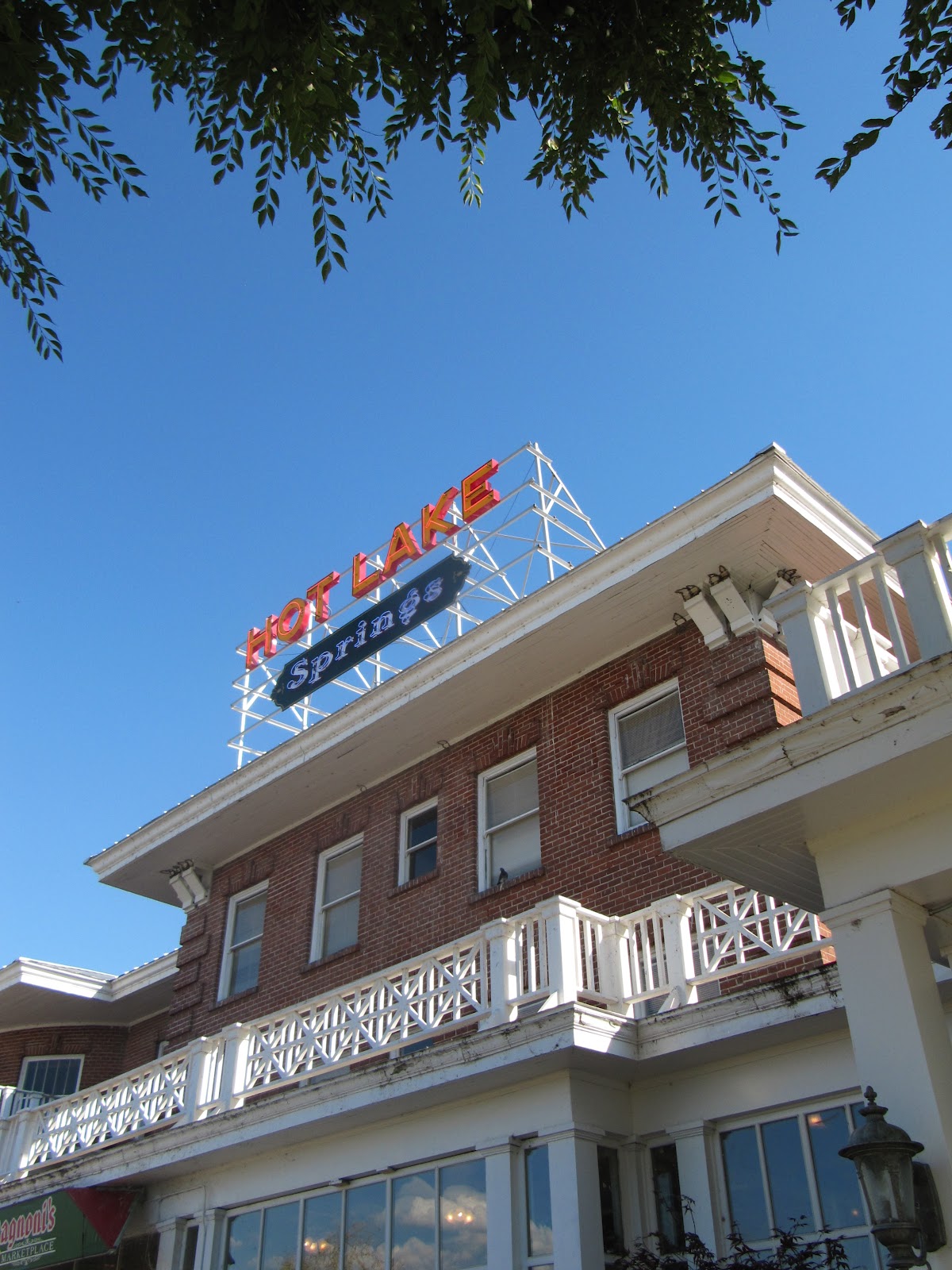
Hot Times at Hot Lake Springs

Hot Lake Springs
During the 1910s and 1920s it was the hottest spot in Oregon. Three daily trains from Portland brought hundreds of guests to “take the waters” at the Hot Lake Hotel and Sanitorium, a little southeast of La Grande. They would bathe in the hot mineral waters, soak in sulfuric baths, and wallow in mud from the lake’s sediment in an attempt to cure a variety of ills from rheumatism to syphilis.
Of course, it had always been a hot spot thanks to the 208-degree water that bubbles out of the ground creating a steaming, sulfurous lake. Native tribes knew about the water’s healing powers and considered the place holy ground. The first whites to enjoy the lake were fur trappers returning from Fort Astoria in 1812; later on, it was a welcome stopover for immigrants traveling the Oregon Trail.
In the 1860s, a number of wooden structures were built around the lake and, in 1908, a three-story brick hotel with hospital was added. The charismatic Dr. William Phy developed it into a state-of-the-art medical facility with labs, operating rooms, teaching hospital, and an innovative x-ray machine that seems more like a prop from a sci-fi horror film. It was often referred to as the Mayo Clinic of the West and attracted patients and spa seekers from all over the world.
Bathhouse and lake
In 1934, a fire destroyed the large wooden structure.  By then, Dr. Phy had died from pneumonia, the railroad was rerouted, the new highway bypassed the property, and the country had plunged into an economic depression. During World War II, it served as a training facility for nurses and later as a nursing home. Over time, the building fell into disrepair.  Vandals had broken all but two of the 360 windows, and looted the fixtures and marble tiles. Holes in the roof allowed water to damage floors and walls. Several attempts to save the structure failed and the future seemed grim for this piece of Oregon history.
At the same time, David Manuel was establishing a reputation as a renowned bronze sculptor and transforming the little town of Joseph in nearby Wallowa County into a noted art community.  He and his wife, Lee, frequently drove by the Hot Lake Hotel observing its sorry condition but also envisioning the property’s potential as a major tourist destination. In 2003 they sold off their interests in Joseph and bought the place. While the old hotel’s foundations were still sound, everything else was a mess and it would be a daunting and expensive task to restore it. Eight years, a lot of hard work, and over $12 million dollars later, Hot Lake Springs was back in business with its grand re-opening in August, 2011.
One of the B & B rooms
Twenty-two of the former hotel rooms have been transformed into a bed and breakfast. Since the rooms were decorated and furnished by local donors, no two are alike. There is a charming breakfast nook and an Italian restaurant on the premise as well as a theater, full service spa, indoor and outdoor soaking tubs. The Manuels also moved their bronze foundry to the site and guests can take a tour and watch a video describing the lost-wax casting process. Many of his pieces, mostly of wildlife and Western themes, are displayed in an on-premise art gallery. Manuel has maintained a long interest in Western art and history, especially Native American history, and a small museum contains an outstanding display of artifacts he has collected over the years.
Outside, there is an antique vehicle display, honor garden, and life-size bronze statue of “The Promised Land,” the same one that occupies Chapman Square in downtown Portland.
The Promised Land
To see more photos and artifacts from Hot Lake’s heyday, take a short drive south to the town of Union with its wonderful county history museum.  The display of medical apparatus and equipment used at the hospital will make you grateful to be living in the 21st century.
To make reservations or view the various rooms online, visit their website at www.hotlakesprings.com.  It is not necessary to be an overnight guest to enjoy the property and tour tickets are available at $10 for adults. This includes the history museum, bronze foundry (tours at 10:00 am and 2:00pm Monday through Saturday) and access to the grounds and indoor facilities.

Saturday, April 14, 2012

Rattlesnake Grade: A Road to Remember

Oregon Highway 3 on its descent to the Grande Ronde River
On the map, Oregon Highway 3 and its continuation, Washington Highway 129, appear to be a direct shot across the upper right-hand corner of the state, connecting Enterprise, Ore. and Clarkston, Wash.  However, the reality of this road is quite different. Why else would the American Motorcycle Association designate it as one of the top 15 motorcycle rides in America? The 80-mile trip offers an enormous variety of scenery from snow-capped peaks, expansive canyons, pine forests, wide open wheat fields, a narrow river valley, ghost town, and enough twists and turns and plunging drop-offs to make a person dizzy. Fortunately, there is very little traffic.

Joseph Canyon Overlook
Traveling from south to north, the drive begins in Enterprise, the county seat of Wallowa County and, more important, home to the last gas stations for the next 65 miles. The road heads north through rolling prairie and ranch land with spectacular views of the Wallowa Mountains receding in the rearview mirror. Elevation gain transforms the scenery to pine forests, and around 30 miles from Enterprise is the Joseph Canyon Overlook. From here, the view spreads out forever across a network of steep canyons. The Nez Perce called the area Saqanma, meaning long, rough canyon, and made their winter camp here at the confluence of Joseph Creek and the Grande Ronde River in the protected canyon’s bottom.

To savor this remarkable panorama, continue a few miles north to the Rim Rock Inn, a restaurant offering indoor and outdoor dining with a million dollar view. Who would expect to find a turkey panini sandwich with sun-dried tomatoes here in the absolute middle of nowhere! A former stagecoach stop, the inn now has four tepees available for rent for adventurous types wanting to spend the night right on the canyon edge.
Flora Methodist Church

Beyond the inn is a road turning west marked “Flora” and well worth the six mile, roundtrip detour to this once thriving farming and ranch community.  Platted in 1897, the town was named for the daughter of the first postmaster and grew to a population of 320 by 1910 with a bank, general store, and newspaper. The Methodist Episcopal Church was constructed in 1898 and an impressive, 8-room school house added to serve the rural community in 1915. However, the area’s isolation and the economic realities of the family farm contributed to the town’s demise and by 1966 the post office closed, followed by the school in 1977.  Today, the town (population 7) consists of a dozen or so abandoned houses and buildings, an overgrown cemetery, and an endless supply of photo opportunities. The church and school with its striking bell tower stand next to each other on the north side of town, dominating the landscape. The school has recently been restored with the idea of converting it to a center for pioneer arts and crafts.

Flora School
Back on Oregon 3, just beyond Buford Ridge Road, look for a pull-off on the left side of the road.  Here is the first, and probably the best, glimpse of the road ahead and explains why it is so popular with motorcyclists. Layer after layer of barren canyon opens up exposing the highway as it snakes its way down to the Grande Ronde River. About half way down, a sign proclaims, Welcome to Washington, The Evergreen State. Of course, in the late summer and early fall the scenery is shades of brown without a tree in sight. At the bridge over the river is a welcome token of civilization, Boggan’s Oasis.  Along the banks of the river, it promises the world’s best milk shakes, tasty burgers, overnight cabins, good fishing, and a swimming hole. It’s an excellent place to freshen up before tackling the next challenge, the ten mile, twisty ascent to the top of Rattlesnake Pass. This is a workout for a car and it seems almost unbelievable that several thousand participants in the 2010 Cycle Oregon tour made this trek on bicycles!

Beyond the pass, the route opens up into a broad plateau, skirts the small farming community of Anatone before one last thrilling corkscrew descent into the town of Asotin on the banks of the mighty Snake River. If the drive was not sufficiently thrilling, consider continuing on across the river to Clarkston. Here, several outfitters offer trips down the scenic Snake River through Hell’s Canyon, the deepest gorge in North America. A smorgasbord of options including full day trips, half days, overnight stays deep in the canyon, and wine and dinner cruises. 

More photos:


Boggan's Oasis, a popular stop for cyclists
 

Tuesday, January 10, 2012

Zumwalt Prairie: High, Wide, and Lonesome

Zumwalt Prairie
Vast grasslands once covered much of northeastern Oregon, eastern Washington, western Idaho and on up into Canada until homesteaders plowed these under to create the great wealth of wheat, potatoes, lentils that make this region famous. However, there was a section in Oregon that was a bit too high in elevation (between 3300’ and 5000’) and a bit too remote for farming to be successful.

Young, red-tailed hawk.
The Zumwalt Prairie, located north and east of the town of Enterprise in Wallowa County, is the largest (about 200 square miles) tract of remaining bunchgrass prairie in North America. Its rolling hills run from bright green in the spring and early summer to shades of yellow and brown as the season progresses. With little sign of human habitation other than a few cattle ranches and plenty of abandoned farmsteads, the place is alive with wildlife including 3,000 elk, black bears, wolves, cougars, bighorn sheep and over 48 varieties of butterflies. The prairie is home to one of North America’s highest concentrations of breeding raptors (golden eagles, prairie falcons, northern harriers, kestrels and numerous varieties of hawks) as well as grassland songbirds.

In 2000 and 2006, The Nature Conservancy purchased 33,000 acres, or about 51 square miles, and has been working in partnership with various state agencies and local ranchers to manage invasive species, develop sustainable grazing practices, and protect animal and plant habitats.
Abandoned farm on Zumwalt Prairie


To visit the prairie, fill up your gas tank and follow Hwy. 82 east of Enterprise about three miles. Turn onto Crow Creek Rd. to Zumwalt Rd. and follow the signs to Buckhorn Overlook. The road soon becomes gravel, but is well graded and fine for most passenger cars. Be sure to stop and look back at the sweeping view of the snow-capped Wallow Mountains. There are a few trailheads off Zumwalt and Duckett Roads, and a trail map produced by The Nature Conservancy is available at the Forest Service center in the town of Joseph.

View from Buckhorn Overlook
Other than the beauty, quiet, and wildlife, the main attraction in the prairie is the Buckhorn Overlook. Located at 5200’, this abandoned fire lookout sits on the edge of the Imnaha River Canyon and offers a view that is nothing short of spectacular. The steep walls of the Cow, Horse, and Lightning Creeks lead into the Imnaha River Canyon and beyond that is Hell’s Canyon (deeper than the Grand Canyon), and beyond that the peaks of the Seven Devils in Idaho. And, the best part of savoring the view is that you will probably have it all to yourself.

Thursday, December 15, 2011

Portland Markets

With the number of days until Christmas dwindling, shoppers seeking local and handmade items should take advantage of two remarkable Portland institutions: the Portland Farmers’ Market and Portland Saturday Market.

Saturday, December 17, marks the end of the season for the Farmers’ Market at the PSU Campus, and the last opportunity for snapping up locally made and grown products. Non-perishable gift ideas include jams and jellies, hazelnuts, smoked salmon, locally processed sausages and pates, vinegars, chocolates and bags of chestnuts for roasting on an open fire. There are always plenty of seasonal fruits and vegetables (a great mushroom selection), plants, and flowers. The market is open from 9:00am to 2:00pm


A tram ride across town ends at the Saturday Market at Ankeny Plaza and Waterfront Park. Since 1974, this outdoor market has offered shoppers an opportunity to buy directly from local artists and craftspeople. You’ll find a wide variety of unusual, one-of-a-kind gifts from jewelry, handmade fashions, bent spoon art, duct tape wallets to a catnip filled body pillow for your favorite feline. There’s always music and entertainment, and a food court with ethnic cuisines from all over the world. While usually open on Saturday and Sundays only, The Festival of the Last Minute runs daily until Christmas Eve at 5:00pm.


Monday, November 7, 2011

Washington County Wineries

Western Washington Co. Vineyards
With the last vestiges of fall color still holding on in what has been a long and spectacular autumn in the Pacific Northwest, it's a perfect time to visit some of the wineries in Washington County. West of Portland and part of  the famed Willamette Valley Appellation, it is the closest winegrowing region to the city and has a long viticulture history, fabulous views, scenic rural roads, and offers a more intimate, laid-back, tasting room experience. If you have only visited large, high-profile California wineries, you are in for a big surprise.
Highway 26, also known as the Sunset Highway, is the main road heading west from Portland to the Coast, and a good route to begin a wine tour of Washington County.  Exit 61 offers an interesting choice. To the south, Shute Road leads into the 21st century, high-tech complex known as the Silicon Forest. To the north, Helvetia Road leads into a country side of rolling pastures and wooden barns; looking not unlike it did in the late 19th century when Swiss immigrants settled here. They named their crossroad community Helvetia, the old Roman term for Switzerland, and turned the fertile land into farms and dairies, some still operated by families of the original homesteaders.
Helvetia Tavern
A short distance north of Highway 26, Helvetia Road dips under a railroad trestle and on the other side is the bright red and green trimmed Helvetia Tavern. Formerly a country store, it is now a popular burger and beer joint and the jumbo, plate-sized hamburgers often appear on lists of Best Burgers in the Portland area. The interior has a homey, rustic feel with wooden floors and a décor featuring baseball caps and beer signs.
Beyond the tavern, the road makes a sharp turn to the west. On the right is Bishop Road with a sign pointing to Helvetia Winery and Christmas Tree Farm. The graveled, washboard road heads uphill passing the Pacific Crest Alpaca Farm where several hundred, purebred alpacas graze, gambol, and generally enjoy their sweeping view of the Coastal Range.
Helvetia Winery
Nearby is the Helvetia Winery, probably the only one in the world that doubles as a Christmas tree farm. Jacob Yungen operated a farm and winery here in the late 1800s when the area was known as Grape Hill. A century later, John Platt and ex-Congresswoman Elizabeth Furse purchased the farm and began growing wine grapes on the southern slopes, eventually opening their winery in 1996. The tasting room is located in the old Yungen farmhouse where, on weekends, visitors can enjoy samples of Chardonnay, Pinot Gris and Pinot Noir. A comfy back porch for lingering over wine, a lovely cottage garden with picnic tables, and a dozen or so dogs add to the rural charm. And, of course, Christmas trees are available for sale along with the wines.
If you purchase a tree, you must make Shafer Vineyards your next stop. Back on Highway 26, exit at Highway 6 and turn south on Gales Creek Road. Harvey and Miki Shafer began growing grapes at their pretty Gales Creek Valley farm in 1973. Like many growers who begin by selling grapes to local wineries, they took the familiar path to making their own wines and by 1981, celebrated their first crush. The 34 acres on south-facing slopes include Pinot Noir, Pinot Gris, Chardonnay, Riesling, Sauvignon Blanc and Gewurtraminer; and you are likely to find a wide array of these varietals being poured at the tasting room bar. To decorate that Christmas tree, be sure to check out Miki’s Christmas shop offering a large assortment of high-end holiday ornaments and collectables. A shaded picnic area and gazebo offer a fine view of the valley and vineyards.
Vineyard views from Tualatin Estate Winery
Return north to the small town of Gales Creek and turn east on Capshaw Hill Road to Tualatin Estate Winery. At the end of a series of gravel roads, Tualatin Estate is not easy to reach, but it’s well worth the effort if only to enjoy the pastoral view of vineyards while sipping a glass of chilled, sparkling Muscat. A former tree nursery, the site was chosen by Californian Bill Fuller in 1973. Fuller had an enology degree from University of California-Davis and had worked for Louis Martini Winery in the Napa Valley for a number of years. He came to Oregon seeking good vineyard land and selected this south-sloping spot and began planting white wine grapes. In 1997, the winery was purchased by Willamette Valley Vineyards and now all the winemaking operations have moved to their facility in Turner, Oregon, near Salem. Wines include Pinot Noir, Pinot Blanc, Chardonnay, Late Harvest Gewurtztraminer, and the spectacular sparkling Muscat. There’s a lovely shaded picnic area with a great view of vineyards and distant hills.
David Hill Winery
From here, continue east on Capshaw Hill Road to Thatcher Kansas City Road and south to David Hill Road and David Hill Winery. The cheerful, lemon yellow, white-trimmed 19th century farmhouse is the perfect setting for a tasting room in one of Oregon’s oldest wineries. In 1883, German immigrant, Ernest Reuter, homesteaded here and planted grapes on the surrounding hillsides. At one point, there were eight wineries in the area and it was known locally as Wine Hill. Most of the vineyards were pulled out during Prohibition and it wasn’t until 1965 when another pioneer, Charles Coury, was attracted to the farm’s grape growing potential. He established some of the first Pinot Noir vineyards in the northern Willamette Valley. Later, the winery experienced a number of changes of ownership, becoming Reuter’s Hill Winery, then Laurel Ridge. In 1992, Milan and Jean Stoyanov bought the property and undertook an extensive renovation of the farmhouse and winery. They chose the name David Hill to honor an early Oregon pioneer. The surrounding vineyards are planted in Pinot Noir, Pinot Gris, Riesling, Chardonnay and Gewurtraminer. When leaving the winery, head uphill a short distance above the tasting room for a classic view of vineyards, forests, and farmland. Return via David Hill Road to Highway 47 and head south. In the little town of Dilley, follow the blue directional signs to Montinore. At the end of the oak-lined lane is a southern-style mansion where it would not be at all strange to see Miss Scarlet in her hoop skirt standing on the columned porch sipping a chilled glass of Riesling. Built in 1905 by John Forbis, a former attorney for Anaconda Copper in Montana, the ranch was named Montinore, a contraction of Montana in Oregon.
Montinore
 With over 585 acres producing 40,000 cases, Montinore is one of the largest Oregon wineries. Owner Rudy Marchesi combines traditional wine making with biodynamic vineyard management to produce highly regarded Pinot Noirs, Gewurtztraminer, Pinot Gris, Riesling and Muller Thurgau. The tasting room’s large picture windows offer an expansive view of the vineyards and the friendly staff will pour your choice of five wines for $5.
While not techically in Washington County, but too close by to miss its special fall foliage view, is Elk Cove Winery. From Montinore, continue south on Hwy. 47 to the small town of Gaston and turn west onto Olson Rd. for about three miles. The tasting room at Elk Cove offers stunning vistas, some equally stunning wines, and a mounted Roosevelt Elk head over the bar.

Vineyards at Elk Cove
There are more than two dozen wineries scattered about Washington County and almost all have tasting rooms. For a good map of the region showing the little, country roads, links to wineries, a video and suggested driving tour check out this informative web site sponsored by the Washington County Visitors Association. It also features nearby restaurants, accommodations, and other area attractions.