Saturday, August 10, 2013

Cascade Locks


Cascade Locks and Bridge of the Gods
In the final chapter of her bestselling book, Wild, author Cheryl Strayed ponders her experiences on the Pacific Crest Trail while enjoying a soft serve cone at the Eastwind Drive-In at Cascade Locks, Ore. Located 40 miles east of Portland off Interstate 84, it’s the only town on the trail’s 2600-mile journey from the Mexican border to Canada, and the spot where the trail crosses the mighty Columbia River via the Bridge of the Gods.
The town, one of the oldest in Oregon, has long been a place where travelers needed to come to terms with their plans. An ancient landslide created a series of whitewater rapids and cascades that served as a major barrier in the river, forcing a long portage around them.  Lewis and Clark described the cascades as “…water passing with great velocity forming and boiling in a horrible manner…”,  and pioneers on the Oregon Trail had to choose between the hard trek over the Barlow Road, or facing the rapids in a make-shift raft with the possibility of losing everything.
 

In 1856, a portage road was built and mules carried freight around the cascades until they were replaced with the Oregon Pony, the first steam locomotive to operate west of the Mississippi. The Pony, described as an “ungainly contraption,” with its tiny engine carried around 200 tons of freight each day. Passengers rode in one small coach or aboard the flatcars.

Historical Museum
The era of portage railroad ended in 1897 when the U.S. Army Corps of Engineers completed a series of locks to move river traffic around the cascades. Later, when the Bonneville Dam and Locks were completed during the New Deal, the waters flooded the old locks leaving only skeletal stone and concrete outlines, and stairs leading to nowhere.  What remains is now a National Historic Site and can be viewed at the town’s Marina Park, owned and operated by the Port of Cascade Locks. This attractive, riverside swatch of parkland is also home to the Oregon Pony which currently resides in its own glass-enclosed and climate-controlled structure.  Next to it, occupying the former lock tender’s house, is the Cascade Locks Historical Museum with three floors of artifacts and mementos from the region’s past.  

At the east end of the park are statues of Lewis and Clark guide, Sacagawea, and their canine traveling companion, Seaman. Next door at the Locks Waterfront Café is the docking site of the Columbia Gorge Sternwheeler, a three-story replica of the ships that cruised the Gorge in the 1800s. Built in 1983 in Hood River, this 499-passenger paddle
Columbia Gorge Sternwheeler
wheeler offers narrated excursions, brunch and dinner cruises on the river between May and October.

A few miles downstream is an attraction well worth a short detour off Interstate 84.  While a working fish hatchery might not be on anyone’s top ten sightseeing list, the Bonneville Hatchery is located in a pretty, creek side setting with stone ponds, flowers, tall trees, and neatly manicured grounds, and receives over a million visitors annually.  The hatchery, opened in 1909, raises fall Chinook salmon, Coho salmon, and summer and winter steelhead. A self-guided tour leads visitors through the process. In the historic, wooden Egg Incubation Building, a small museum covers everything anyone would want to know about salmon and their fascinating life cycle. However, the biggest and best known attraction at the hatchery is Herman, a 70-year-old, 450 pounds, ten foot
Egg Incubation Building and Museum
long sturgeon. He and his buddies can be observed through an underwater, glass window. The adjacent Bonneville Dam and Locks also welcomes visitors.

Cascade Locks is the nearest town to a number of popular Columbia Gorge hiking trails.  In addition to the Pacific Coast Trail, there is access nearby to the Eagle Creek and Wahclella Falls trails offering some of the Gorge’s most spectacular scenery and waterfalls. This spring, a new mountain bike trail opened on the east side of town.
Herman


Saturday, June 22, 2013

Bandon-by-the-Sea


When Irish immigrant George Bennett arrived at the mouth of the Coquille River on the southern Oregon Coast he brought the name of his Irish hometown, Bandon, to the new settlement.  Additionally, he brought an Irish shrub called gorse (ulex europaeus) and planted it as a fence hedge surrounding his property.
Gorse is plentiful along Oregon's South Coast
This ornamental evergreen with its bright yellow blossoms soon infested the area, spreading along the sand dunes and throughout the town. Unfortunately, the high oil content of its foliage made the plant extremely flammable, a factor that would change Bandon forever.

In 1936, the town was a thriving community: a logging and fishing center, home to cows and cranberries, and the busiest port between San Francisco and Portland. On a warm and dry September evening, a shift in winds brought a nearby forest fire closer to town. When it reached the gorse, the fire exploded into an inferno completely destroying the entire commercial district in a short time and leaving 1800 inhabitants homeless.

Coquille River Lighthouse
Like the mythological Phoenix, the town rose from the ashes and rebuilt itself. Today, Bandon-by-the-Sea, as it is known in tourism parlance, is a favorite destination on the Oregon Coast. The Bandon Dunes Golf Resort, a complex of five courses just north of town, attracts players from all over the world. Set on a bluff overlooking the ocean and dunes, it consistently appears on any list of top ten golf courses and compares favorably to some of the best in Scotland and Ireland.

There is more than golf to keep visitors coming back. Like any coastal community, the ocean is the big draw, and the setting in Bandon couldn’t be more spectacular. Wide, sandy beaches are easily accessible and offer a plethora of driftwood, agates, jasper, and petrified wood. Offshore are wildly sculpted sea stacks and monolithic rock formations providing sanctuary for a wide variety of sea birds. Where the Coquille River meets the ocean, an octagonal lighthouse with a tall round tower stands guard over the perilous bar. Built in 1896, it was the last lighthouse constructed along the Oregon Coast. It was decommissioned in 1939, but volunteers and lighthouse enthusiasts keep this landmark maintained and opened to the public during summer months.

Wooden, welcome arches lure travelers along Highway 101 to detour into Bandon’s Old Town. This compact downtown offers a variety of shops, galleries, restaurants, an excellent history museum, independent bookstore, and plenty of free parking. A walkable waterfront lines one of the two main streets allowing close access to fishing boats, charters, and fresh seafood. Bandon Fish
Market makes a tasty stop for fish and chips followed by a dessert visit to Cranberry Sweets located across the street. This local institution features all sorts of cranberry candy goodies, and they are most generous with their free samples.

Cranberries are an important business here and Bandon boasts of being “The Cranberry Capital of Oregon.” The acidic, sandy soil and mild climate make it a perfect place for cranberries and there are nearly 1600 acres under cultivation. Bogs can be seen along Highway 101 north and south of town with most of these berries destined for bottles of Ocean Spray juice.  On the second full weekend in September, the town celebrates this crop with a four-day cranberry festival.

Bandon Fish Market
Bandon is also known for its dairy industry and for years, Bandon Cheese was a popular stop for visitors traveling the coast. After the business was sold to Tillamook Cheese, the creamery and retail store closed, but a new cheese factory opened this spring. Face Rock Creamery will be offering a variety of their locally made cheddars as well as squeaky cheese curds and Umpqua ice cream cones.

The town of Bandon is bookended by two state parks. To the north is Bullards Beach State Park with a large campground, sandy beach, and access to the lighthouse. To the south, is a string of state owned lands including Face Rock Scenic Viewpoint and Bandon Natural Area offering beach access and close-up viewing of the rock formations offshore. Beach Loop Road parallels the ocean, connecting all these scenic vistas. No trip to Bandon would be complete without a stop at 11th Avenue and Beach Loop Road at Coquille Point for a calendar view of the very best of the Oregon Coast.

From Coquille Point

Sunday, May 19, 2013

Memorial Day Monuments


For many, Memorial Day signals the beginning of summer, the kickoff of white shoe season, the Indy 500, Oregon winery open-house weekend, and yet another federal three-day holiday. However, it is important to reflect on the history and significance of this day that honors the men and women in the military services who have made the ultimate sacrifice for their country.
Soldier's Monument, Lone Fir Cemetery
Originally known as Decoration Day, the holiday’s beginnings are a little fuzzy depending on a Yankee or Confederate perspective. At the end of the Civil War, in May of 1868, Commander of the Grand Army of the Republic, General John Logan, officially proclaimed May 30 a day of commemoration, and flowers were placed on the graves of the 20,000 Union and Confederate soldiers buried in Arlington National Cemetery. Southern states refused to follow the May 30 tradition and had their own Confederate Memorial Days. By the end of World War I, the observance was expanded to include fallen soldiers of all wars and in 1971, it became officially known as Memorial Day and observed on the last Monday in the month of May.
The Portland area features a number of war and veteran memorials, many of them tucked out of the way, others in public areas but largely ignored. The oldest monument honoring the war dead is in Lone Fir Cemetery on 26th SE, between Stark and Morrison. The Soldier’s Monument, near the center of the cemetery, was dedicated in 1903 to the veterans of the Civil War, Mexican, Spanish, and Indian Wars and is typical of that era, a bronze soldier with flag standing on top a stone pediment. The cemetery, dating back to 1846, is final home to over 200 Civil War veterans.

Lownsdale Square, Portland
Another pedestal-soldier style monument is located in downtown Portland in Lownsdale Square at the intersection of SW 4th and Main. Unveiled in 1906, Soldiers Monument is dedicated to Oregonians killed in the Spanish American War. The tall, granite obelisk is topped by a bronze replica of an infantryman of the Second Oregon U.S. Volunteer Infantry. At the base of the statue are two Howitzers used at Fort Sumter at the start of the Civil War.  One points north; the other south.

Across the Willamette River, in the Rose Quarter, stands the Veterans Memorial Coliseum. This indoor arena with its unusual glass design was built in 1960 and dedicated in 1961 to the veterans of World Wars I and II. Two black, polished granite slabs inscribed with the names of the fallen sit at a lower level on either side of the main entrance.

Korean War Memorial, Wilsonville
Many veterans of these two wars are interred in the Willamette National Cemetery located east of I-205 (one of many Blue Star Memorial Highways in Oregon) on the flanks of Mt. Scott. The largest military cemetery east of the Mississippi, it covers over 300 acres and the beautiful, hillside setting provides panoramic views of Portland. Several Medal of Honor recipients as well as former Senator and Governor Mark Hatfield are buried here along with nearly 150,000 veterans and their family members. Korean War veterans are honored with a large granite monument listing the names of the 283 Oregonians lost in that conflict. South of Portland, in the city of Wilsonville is another memorial honoring Korean War vets. Located in the Town Center Park, the 94-foot long pink granite wall also lists those servicemen killed.

Vietnam Memorial, Washington Park
Probably the most striking of all Portland’s war memorials is the Vietnam Veterans of Oregon Memorial in Washington Park, between Hoyt Arboretum and the World Forestry Center. Set in a verdant bowl surrounded by tall trees, the monument was dedicated in 1987 to the more than 700 men and women who died or remain missing in action in that conflict. A spiral path follows the contour of the bowl and is lined with several curved granite walls representing the years between 1959 and 1976. The names of those lost are engraved on the stone along with information about the history of the war during that time period and news from the home front here in Oregon. The “news” runs the gamut from the notable to the nonsensical and provides a provocative contrast to the war and the lost lives.

Vietnam Memorial, Washington Park
While flipping your burgers and grilling your hot dogs this Memorial Day, take just a moment to remember that freedom is never free; or, better yet, take a bouquet of flowers to one of these monuments

Monday, March 18, 2013

Ghost Canneries of the Lower Columbia River


 It was much more than our childhood memories of those unsavory, school-lunch salmon patties served with creamed peas that brought down the salmon cannery business along the lower Columbia.  A combination of overfishing, degradation of spawning habitat upstream, and the construction of dams on the Columbia and its tributaries combined to destroy what had been in early history, salmon runs estimated as large as 16 million annually.

For centuries, natives fished the river, preserving the salmon through smoking or drying processes. Early Europeans tried salting and packing salmon in barrels which were shipped to Hawaii and the East Coast with mixed results. However, improvements in canning methods meant the fish could be packed safely and travel all over the world.  The Hume brothers opened the first salmon cannery in 1866 in Eagle Cliff, Washington, a few miles upstream from present day Cathlamet. Their success spawned the development of more canneries along the lower Columbia River, and by the heyday of the late 1880s, there were 38 canneries in the area, packing as much as 30 million, one-pound cans a year. That’s a lot of potential salmon patties.

Pier 39, Astoria
The canneries brought jobs to the area along with a rich mix of ethnic groups whose cultures and influence have remained.  In the early days, much of the dirty work of butchering salmon was done by Chinese men supplied by labor contractors out of San Francisco.  With the Chinese Exclusion Act of 1882, canneries turned to Filipinos and Japanese workers, while at the same time immigrants from Scandinavia, Finland, Yugoslavia and the Mediterranean arrived to fish and labor in the canneries.

Inside the Bumble Bee Museum
Astoria, Oregon, was the center of the canning business and carried the moniker, Cannery Capital of the World. Once home to 22 canneries, it’s a good place to begin a tour of what remains of this important industry.  Nearly all the wooden cannery buildings have succumbed to old age and blustery winter storms, but a few remain in Astoria. At the end of 39th St. on the eastern end of town is Pier 39, the old Hanthorn/Bumble Bee Cannery.  It was the last operating cannery in the area, closing in 1980. Today it houses a coffee shop, pub, and the free Bumble Bee museum. Inside are wooden gill-netter boats, old cannery processing equipment, and photos of the days when Bumble Bee was Astoria’s largest employer.

Big Red, Astoria
Nearby, at the end of 31st St., is a large, hulking, red building sitting out in the river and looking a bit tattered. Known as Big Red, it served as a satellite station for Union Fishermen’s Coop where fishermen could drop off their catch and spread their nets to dry. Over 100 years old, the wooden structure lost its top story in a wind storm in 2007, but efforts are underway to save this piece of history.

Cross the Astoria-Megler Bridge to the Washington side of the river and follow Hwy 401 east to Knappton Cove. Rotting wooden posts extending out into the water are all that remain of the Eureka and Epicure Packing Co. In 1899, the federal government built a quarantine station on the site of the abandoned cannery. Ships arriving in Astoria were inspected for any signs of contagious diseases. If infected, they were directed across the river to the quarantine station, or pest house.  Ships were fumigated with burning sulfur and passengers treated for disease. Today the building houses a museum open on Saturdays during summer months.
Knappton Cove Quarantine Station

Altoona, Washington
A bit further east, a winding road leads south from Rosburg to the ghost town of Altoona. A few houses and wooden pilings in the river are all that remain of a town that was once a major port for steamers traveling between Portland and Astoria. This stretch of the river had six canneries in the early 1900s, but today it is a quiet spot in a beautiful setting.  Large rock pillars topped with hemlocks sit in the harbor, and the end-of-the-road atmosphere makes it well worth the 13-mile, round-trip detour.

In the town of Cathlamet along the riverfront, a little upstream from the boarded-up Water Rat Tap Tavern, is what remains of the Warren Cannery. Two years ago, a large part of the building collapsed and today what little remains is being salvaged. Once gone, it will join its fellow ghost canneries along the lower Columbia.
Remnants of the Warren Cannery, Cathlamet

Saturday, March 16, 2013

Following the Flight of the Nez Perce


One of the most tragic events in American history began with the definition of the word, home.  To the settlers of the newly-opened West, it meant a permanent house with a barn on a piece of tillable land. To the Nez Perce tribe, or Nimiipuu, “home” encompassed a wide swath of northeastern Oregon, southwestern Washington, and central Idaho. A nomadic tribe, their ancestors had lived here for generations following their seasonal food sources of camas root, salmon, and game. From their first encounter with white men, the Lewis and Clark expedition, the Nez Perce lived in harmony with their new neighbors. However, a revised reservation boundary drawn up in 1863 forced the tribe into 700,000 acres near Lapwai, Idaho. A number of Nez Perce, including Chief Joseph’s Wallowa band, refused to sign and relinquish their “home;” they became known as “non-treaty” Indians. Relations grew tense and in 1877, the U.S. Army, under the command of General O.O. Howard, was ordered to remove the non-treaties to the Lapwai reservation, triggering a 1,100-mile pursuit across Oregon, Idaho, Montana, and Wyoming.


Nez Perce Nat'l Historic Park Visitor Center
To follow the actual route the Nez Perce took requires a four-wheel drive and, perhaps, a horse, but a passenger car will get you close enough to understand the human endurance required to make this journey. The fact that the route passes through some of the most scenic landscape in the West is an extra bonus. A good starting point is the Nez Perce National Historical Park Visitor Center on US 95, east of Lewiston, Idaho. Located on the site where Henry and Elizabeth Spalding established their Presbyterian mission, the center offers a video, display of Nez Perce artifacts, along with a selection of books and maps.

White Bird Overlook
Continuing on US 95, a slight detour south of Grangeville leads to the White Bird Battlefield overlook.  Interpretive signs tell the story of the first encounter between Howard’s army and Nez Perce warriors. At the end, 34 soldiers were killed.  While they suffered no casualties, Chief Joseph’s band of 750 people and 2,000 horses realized their best hope of safety was to travel east to Buffalo Country, and seek help from their allies, the Crow tribe.

U.S. 12 crosses North Central Idaho
Their journey followed the Lolo Trail over the Bitterroot Mountains in central Idaho, a route closely approximated today by US 12. Not completed until 1962, this winding, two-lane road follows the Clearwater and Lochsa Rivers through some of the most pristine, remaining wilderness areas. Known as the Northwest Passage Scenic Byway, It parallels the route used by Lewis and Clark and ends at Lolo Pass on the Montana border.


Bitterroot Valley, Western Montana
When the Nez Perce arrived here they falsely assumed they had left the war and pursuing army behind them, and turned south following the Bitterroot Valley. US 93 is the primary route through this lovely valley today, but this busy stretch of road can be avoided by traveling on parallel highway 269.  Not only is the scenery better, but the road passes through the small towns of Stevensville with its old Catholic mission, and Hamilton where you can tour the 25-room mansion of Copper King, Marcus Daly.

Big Hole National Battlefield Site
At the end of the valley, the route crosses the Continental Divide into the Big Hole. By this time, the Nez Perce were feeling comfortable enough to stop for some much needed rest. They set up their teepees along the banks of a stream and settled in. Before dawn on August 9, Colonel Gibbons and the 7th Infantry fired on the unsuspecting, sleeping village and the Big Hole Battle began. By the end of the carnage, both sides had sustained large losses. After burying their dead, the Nez Perce quickened their retreat across southwestern Montana, headed toward Yellowstone Park.

The road to Bannock Pass
A visitor center at the Big Hole National Battlefield Site offers a broad view of the valley where the fighting took place and an excellent video describing events. Beyond here, the road over Bannock Pass and eastward across Idaho is gravel, but well-graded and easy except for the occasional recalcitrant cow.

At Yellowstone, the army established traps at every exit to the east, but, once again, the Nez Perce managed to evade them. However, it soon became apparent that the Crow would be of no assistance and their only remaining hope was to travel north to asylum in Canada. By then, this ragtag band, now largely women, children and the elderly, had covered over a thousand miles and were exhausted.  Pausing at the Bear Paw Mountains, they were overtaken by the army and after a six-day siege, Chief Joseph surrendered his band, only 40 miles from the Canadian border. A monument marks the lonely, windswept spot.

Sunday, October 7, 2012

Ballard Offers Some of Seattle's Best


Ballard Locks
Like Portland, Seattle is a city defined by its neighborhoods. One of the oldest and most interesting for out-of-towners to visit is Ballard, in the northwestern part of town bordering Puget Sound and the Lake Washington Ship Canal. The area was settled in the 1860s by Scandinavian immigrants who came to work in the lumber and fishing industries, just as they had in their native lands. Local timber mills cranked out millions of roofing shingles earning Ballard the enticing nickname, Shingle Capital of the World. Scandinavian fishermen developed the Fishermen’s Terminal on the other side of the Ballard Bridge, and it is today home base for the North Pacific Fishing Fleet, one of the world’s largest, and a fun place to wander around.

Ballard Farmers Market
Ballard was a separate city at first, but was annexed by the much larger Seattle in 1907.  Long known as a blue-collar, working-class neighborhood where you could buy Norwegian culinary delights like lutefisk and lefsa, the area is becoming gentrified and transitioning into a hip, urban village. Historic commercial buildings now house boutiques, trendy shops, chic cafes, and live music clubs.

On Sundays, year around, Ballard hosts what many consider to be the best farmers’ market in Seattle. Tree-lined Ballard Avenue is closed to traffic and vendors selling seasonal produce, flowers, cheese, and pastries take over the street from 10:00 am to 3:00 pm. At the western end of Ballard Avenue is a small park and tower containing the original city hall bell. King Carl XVI Gustaf traveled all the way from Sweden to ring this bell in 1976, officially dedicating the Ballard Avenue Historic District.

Nordic Heritage Museum
The Nordic Heritage Museum, located in an old school in a residential neighborhood, celebrates Ballard’s Scandinavian roots. On the first floor, the Dream of America exhibit chronicles the story of immigration from Europe to the Pacific Northwest; the second floor galleries tell the story of logging and fishing, the two primary employers of immigrants; and the third floor has rooms featuring the costumes, crafts, and stories from each of the five ethnic groups: Norway, Sweden, Finland, Iceland, and Denmark.  It is interesting to note that in 1910, one third of Seattle’s immigrant population was from one of these five countries. There is also a gift shop featuring Scandinavian books and knick knacks.

However, Ballard’s biggest tourist attraction, drawing in over a million visitors a year, is the Hi


Chinook Salmon heading home.
ram M. Chittenden Locks complex located in the neighborhood’s west end. Known locally as the Ballard Locks, they were first opened in 1917, and are operated by the U.S. Army Corps of Engineers. The locks connect Puget Sound with Washington and Union Lakes and serve to keep the saltwater out of the freshwater lakes, and to raise and lower boats the 26-foot difference between the bodies of water. Nearly 100,000 ships a year pass through the locks, and on any given day you might see commercial fishing boats, pricey yachts, kayaks, and tugboats all waiting for a lift. Adjacent, and part of the locks, are a series of fish ladders built to help salmon on their upstream migration from the ocean back to the headwaters of the Sammamish River, a feeder to Lake Washington.  Underwater, glass panels allow for a close-up observation of the fish, and the best viewing season is from June to early October.  Also on the grounds of the locks, is a seven acre botanical garden featuring a large collection of rare and unusual shrubs and plants.


Puget Sound and Olympic Mtns. from Ray's Boathouse
If watching the salmon navigate the fish ladders has whetted your appetite for some seafood, you’re in luck. Right outside the entrance to the locks is the Lockspot Café, known for their “world famous” fish and chips. For something a little more upscale, Ray’s Boathouse is only a short drive west along Seaview Avenue. This Seattle institution is well-known for its fresh, Pacific Northwest seafood as well as its panoramic view of Puget Sound fringed by the snow-capped Olympic Mountains.


Friday, August 10, 2012

Hot Times at Hot Lake Springs

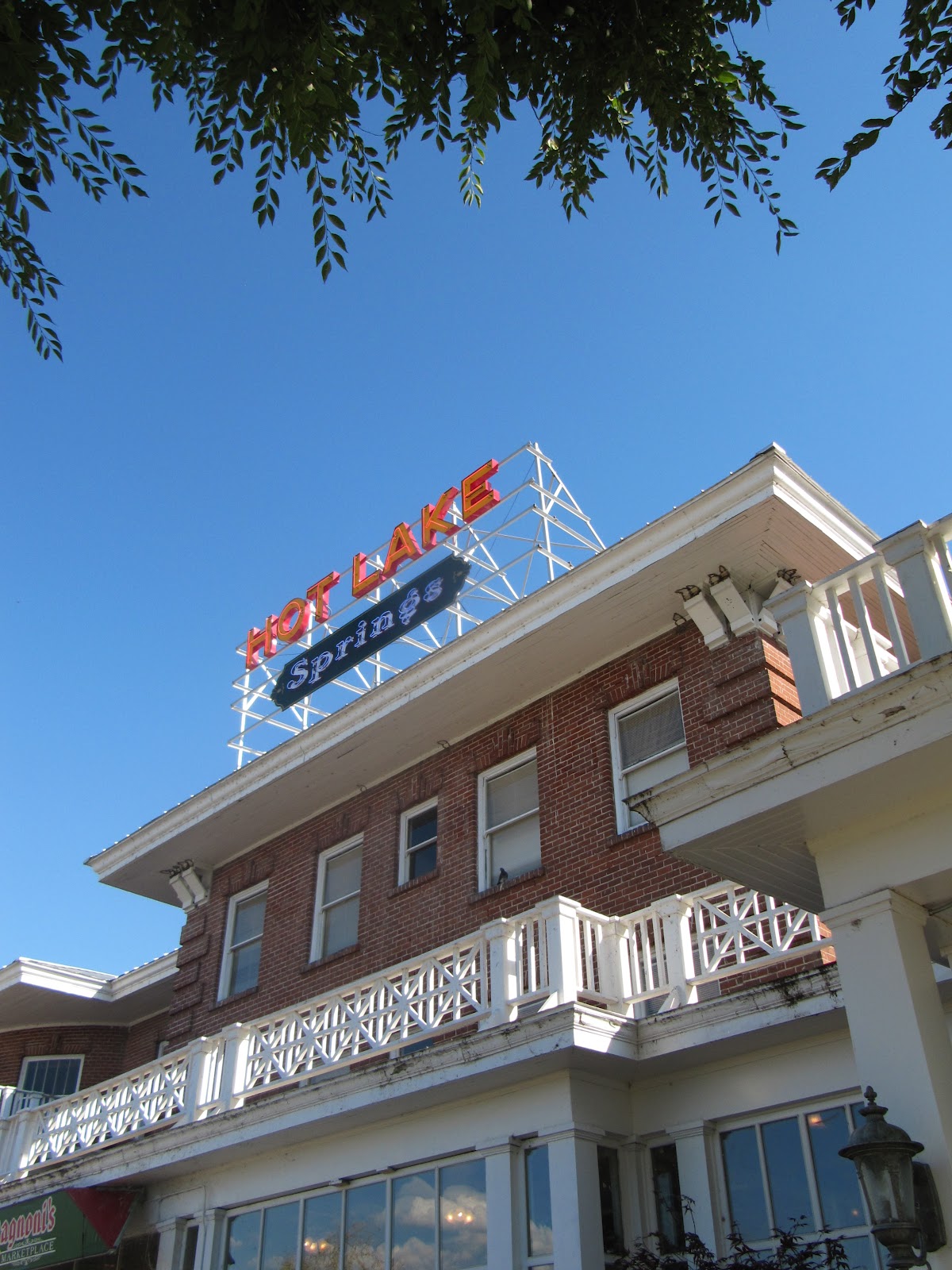
Hot Lake Springs
During the 1910s and 1920s it was the hottest spot in Oregon. Three daily trains from Portland brought hundreds of guests to “take the waters” at the Hot Lake Hotel and Sanitorium, a little southeast of La Grande. They would bathe in the hot mineral waters, soak in sulfuric baths, and wallow in mud from the lake’s sediment in an attempt to cure a variety of ills from rheumatism to syphilis.
Of course, it had always been a hot spot thanks to the 208-degree water that bubbles out of the ground creating a steaming, sulfurous lake. Native tribes knew about the water’s healing powers and considered the place holy ground. The first whites to enjoy the lake were fur trappers returning from Fort Astoria in 1812; later on, it was a welcome stopover for immigrants traveling the Oregon Trail.
In the 1860s, a number of wooden structures were built around the lake and, in 1908, a three-story brick hotel with hospital was added. The charismatic Dr. William Phy developed it into a state-of-the-art medical facility with labs, operating rooms, teaching hospital, and an innovative x-ray machine that seems more like a prop from a sci-fi horror film. It was often referred to as the Mayo Clinic of the West and attracted patients and spa seekers from all over the world.
Bathhouse and lake
In 1934, a fire destroyed the large wooden structure.  By then, Dr. Phy had died from pneumonia, the railroad was rerouted, the new highway bypassed the property, and the country had plunged into an economic depression. During World War II, it served as a training facility for nurses and later as a nursing home. Over time, the building fell into disrepair.  Vandals had broken all but two of the 360 windows, and looted the fixtures and marble tiles. Holes in the roof allowed water to damage floors and walls. Several attempts to save the structure failed and the future seemed grim for this piece of Oregon history.
At the same time, David Manuel was establishing a reputation as a renowned bronze sculptor and transforming the little town of Joseph in nearby Wallowa County into a noted art community.  He and his wife, Lee, frequently drove by the Hot Lake Hotel observing its sorry condition but also envisioning the property’s potential as a major tourist destination. In 2003 they sold off their interests in Joseph and bought the place. While the old hotel’s foundations were still sound, everything else was a mess and it would be a daunting and expensive task to restore it. Eight years, a lot of hard work, and over $12 million dollars later, Hot Lake Springs was back in business with its grand re-opening in August, 2011.
One of the B & B rooms
Twenty-two of the former hotel rooms have been transformed into a bed and breakfast. Since the rooms were decorated and furnished by local donors, no two are alike. There is a charming breakfast nook and an Italian restaurant on the premise as well as a theater, full service spa, indoor and outdoor soaking tubs. The Manuels also moved their bronze foundry to the site and guests can take a tour and watch a video describing the lost-wax casting process. Many of his pieces, mostly of wildlife and Western themes, are displayed in an on-premise art gallery. Manuel has maintained a long interest in Western art and history, especially Native American history, and a small museum contains an outstanding display of artifacts he has collected over the years.
Outside, there is an antique vehicle display, honor garden, and life-size bronze statue of “The Promised Land,” the same one that occupies Chapman Square in downtown Portland.
The Promised Land
To see more photos and artifacts from Hot Lake’s heyday, take a short drive south to the town of Union with its wonderful county history museum.  The display of medical apparatus and equipment used at the hospital will make you grateful to be living in the 21st century.
To make reservations or view the various rooms online, visit their website at www.hotlakesprings.com.  It is not necessary to be an overnight guest to enjoy the property and tour tickets are available at $10 for adults. This includes the history museum, bronze foundry (tours at 10:00 am and 2:00pm Monday through Saturday) and access to the grounds and indoor facilities.