Saturday, March 16, 2013

Following the Flight of the Nez Perce


One of the most tragic events in American history began with the definition of the word, home.  To the settlers of the newly-opened West, it meant a permanent house with a barn on a piece of tillable land. To the Nez Perce tribe, or Nimiipuu, “home” encompassed a wide swath of northeastern Oregon, southwestern Washington, and central Idaho. A nomadic tribe, their ancestors had lived here for generations following their seasonal food sources of camas root, salmon, and game. From their first encounter with white men, the Lewis and Clark expedition, the Nez Perce lived in harmony with their new neighbors. However, a revised reservation boundary drawn up in 1863 forced the tribe into 700,000 acres near Lapwai, Idaho. A number of Nez Perce, including Chief Joseph’s Wallowa band, refused to sign and relinquish their “home;” they became known as “non-treaty” Indians. Relations grew tense and in 1877, the U.S. Army, under the command of General O.O. Howard, was ordered to remove the non-treaties to the Lapwai reservation, triggering a 1,100-mile pursuit across Oregon, Idaho, Montana, and Wyoming.


Nez Perce Nat'l Historic Park Visitor Center
To follow the actual route the Nez Perce took requires a four-wheel drive and, perhaps, a horse, but a passenger car will get you close enough to understand the human endurance required to make this journey. The fact that the route passes through some of the most scenic landscape in the West is an extra bonus. A good starting point is the Nez Perce National Historical Park Visitor Center on US 95, east of Lewiston, Idaho. Located on the site where Henry and Elizabeth Spalding established their Presbyterian mission, the center offers a video, display of Nez Perce artifacts, along with a selection of books and maps.

White Bird Overlook
Continuing on US 95, a slight detour south of Grangeville leads to the White Bird Battlefield overlook.  Interpretive signs tell the story of the first encounter between Howard’s army and Nez Perce warriors. At the end, 34 soldiers were killed.  While they suffered no casualties, Chief Joseph’s band of 750 people and 2,000 horses realized their best hope of safety was to travel east to Buffalo Country, and seek help from their allies, the Crow tribe.

U.S. 12 crosses North Central Idaho
Their journey followed the Lolo Trail over the Bitterroot Mountains in central Idaho, a route closely approximated today by US 12. Not completed until 1962, this winding, two-lane road follows the Clearwater and Lochsa Rivers through some of the most pristine, remaining wilderness areas. Known as the Northwest Passage Scenic Byway, It parallels the route used by Lewis and Clark and ends at Lolo Pass on the Montana border.


Bitterroot Valley, Western Montana
When the Nez Perce arrived here they falsely assumed they had left the war and pursuing army behind them, and turned south following the Bitterroot Valley. US 93 is the primary route through this lovely valley today, but this busy stretch of road can be avoided by traveling on parallel highway 269.  Not only is the scenery better, but the road passes through the small towns of Stevensville with its old Catholic mission, and Hamilton where you can tour the 25-room mansion of Copper King, Marcus Daly.

Big Hole National Battlefield Site
At the end of the valley, the route crosses the Continental Divide into the Big Hole. By this time, the Nez Perce were feeling comfortable enough to stop for some much needed rest. They set up their teepees along the banks of a stream and settled in. Before dawn on August 9, Colonel Gibbons and the 7th Infantry fired on the unsuspecting, sleeping village and the Big Hole Battle began. By the end of the carnage, both sides had sustained large losses. After burying their dead, the Nez Perce quickened their retreat across southwestern Montana, headed toward Yellowstone Park.

The road to Bannock Pass
A visitor center at the Big Hole National Battlefield Site offers a broad view of the valley where the fighting took place and an excellent video describing events. Beyond here, the road over Bannock Pass and eastward across Idaho is gravel, but well-graded and easy except for the occasional recalcitrant cow.

At Yellowstone, the army established traps at every exit to the east, but, once again, the Nez Perce managed to evade them. However, it soon became apparent that the Crow would be of no assistance and their only remaining hope was to travel north to asylum in Canada. By then, this ragtag band, now largely women, children and the elderly, had covered over a thousand miles and were exhausted.  Pausing at the Bear Paw Mountains, they were overtaken by the army and after a six-day siege, Chief Joseph surrendered his band, only 40 miles from the Canadian border. A monument marks the lonely, windswept spot.

Sunday, October 7, 2012

Ballard Offers Some of Seattle's Best


Ballard Locks
Like Portland, Seattle is a city defined by its neighborhoods. One of the oldest and most interesting for out-of-towners to visit is Ballard, in the northwestern part of town bordering Puget Sound and the Lake Washington Ship Canal. The area was settled in the 1860s by Scandinavian immigrants who came to work in the lumber and fishing industries, just as they had in their native lands. Local timber mills cranked out millions of roofing shingles earning Ballard the enticing nickname, Shingle Capital of the World. Scandinavian fishermen developed the Fishermen’s Terminal on the other side of the Ballard Bridge, and it is today home base for the North Pacific Fishing Fleet, one of the world’s largest, and a fun place to wander around.

Ballard Farmers Market
Ballard was a separate city at first, but was annexed by the much larger Seattle in 1907.  Long known as a blue-collar, working-class neighborhood where you could buy Norwegian culinary delights like lutefisk and lefsa, the area is becoming gentrified and transitioning into a hip, urban village. Historic commercial buildings now house boutiques, trendy shops, chic cafes, and live music clubs.

On Sundays, year around, Ballard hosts what many consider to be the best farmers’ market in Seattle. Tree-lined Ballard Avenue is closed to traffic and vendors selling seasonal produce, flowers, cheese, and pastries take over the street from 10:00 am to 3:00 pm. At the western end of Ballard Avenue is a small park and tower containing the original city hall bell. King Carl XVI Gustaf traveled all the way from Sweden to ring this bell in 1976, officially dedicating the Ballard Avenue Historic District.

Nordic Heritage Museum
The Nordic Heritage Museum, located in an old school in a residential neighborhood, celebrates Ballard’s Scandinavian roots. On the first floor, the Dream of America exhibit chronicles the story of immigration from Europe to the Pacific Northwest; the second floor galleries tell the story of logging and fishing, the two primary employers of immigrants; and the third floor has rooms featuring the costumes, crafts, and stories from each of the five ethnic groups: Norway, Sweden, Finland, Iceland, and Denmark.  It is interesting to note that in 1910, one third of Seattle’s immigrant population was from one of these five countries. There is also a gift shop featuring Scandinavian books and knick knacks.

However, Ballard’s biggest tourist attraction, drawing in over a million visitors a year, is the Hi


Chinook Salmon heading home.
ram M. Chittenden Locks complex located in the neighborhood’s west end. Known locally as the Ballard Locks, they were first opened in 1917, and are operated by the U.S. Army Corps of Engineers. The locks connect Puget Sound with Washington and Union Lakes and serve to keep the saltwater out of the freshwater lakes, and to raise and lower boats the 26-foot difference between the bodies of water. Nearly 100,000 ships a year pass through the locks, and on any given day you might see commercial fishing boats, pricey yachts, kayaks, and tugboats all waiting for a lift. Adjacent, and part of the locks, are a series of fish ladders built to help salmon on their upstream migration from the ocean back to the headwaters of the Sammamish River, a feeder to Lake Washington.  Underwater, glass panels allow for a close-up observation of the fish, and the best viewing season is from June to early October.  Also on the grounds of the locks, is a seven acre botanical garden featuring a large collection of rare and unusual shrubs and plants.


Puget Sound and Olympic Mtns. from Ray's Boathouse
If watching the salmon navigate the fish ladders has whetted your appetite for some seafood, you’re in luck. Right outside the entrance to the locks is the Lockspot CafĂ©, known for their “world famous” fish and chips. For something a little more upscale, Ray’s Boathouse is only a short drive west along Seaview Avenue. This Seattle institution is well-known for its fresh, Pacific Northwest seafood as well as its panoramic view of Puget Sound fringed by the snow-capped Olympic Mountains.


Friday, August 10, 2012

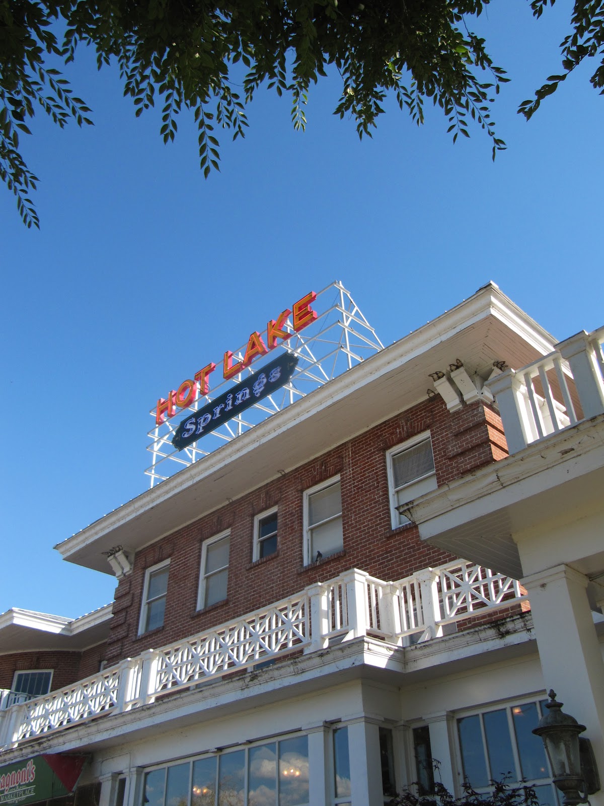
Hot Times at Hot Lake Springs

Hot Lake Springs
During the 1910s and 1920s it was the hottest spot in Oregon. Three daily trains from Portland brought hundreds of guests to “take the waters” at the Hot Lake Hotel and Sanitorium, a little southeast of La Grande. They would bathe in the hot mineral waters, soak in sulfuric baths, and wallow in mud from the lake’s sediment in an attempt to cure a variety of ills from rheumatism to syphilis.
Of course, it had always been a hot spot thanks to the 208-degree water that bubbles out of the ground creating a steaming, sulfurous lake. Native tribes knew about the water’s healing powers and considered the place holy ground. The first whites to enjoy the lake were fur trappers returning from Fort Astoria in 1812; later on, it was a welcome stopover for immigrants traveling the Oregon Trail.
In the 1860s, a number of wooden structures were built around the lake and, in 1908, a three-story brick hotel with hospital was added. The charismatic Dr. William Phy developed it into a state-of-the-art medical facility with labs, operating rooms, teaching hospital, and an innovative x-ray machine that seems more like a prop from a sci-fi horror film. It was often referred to as the Mayo Clinic of the West and attracted patients and spa seekers from all over the world.
Bathhouse and lake
In 1934, a fire destroyed the large wooden structure.  By then, Dr. Phy had died from pneumonia, the railroad was rerouted, the new highway bypassed the property, and the country had plunged into an economic depression. During World War II, it served as a training facility for nurses and later as a nursing home. Over time, the building fell into disrepair.  Vandals had broken all but two of the 360 windows, and looted the fixtures and marble tiles. Holes in the roof allowed water to damage floors and walls. Several attempts to save the structure failed and the future seemed grim for this piece of Oregon history.
At the same time, David Manuel was establishing a reputation as a renowned bronze sculptor and transforming the little town of Joseph in nearby Wallowa County into a noted art community.  He and his wife, Lee, frequently drove by the Hot Lake Hotel observing its sorry condition but also envisioning the property’s potential as a major tourist destination. In 2003 they sold off their interests in Joseph and bought the place. While the old hotel’s foundations were still sound, everything else was a mess and it would be a daunting and expensive task to restore it. Eight years, a lot of hard work, and over $12 million dollars later, Hot Lake Springs was back in business with its grand re-opening in August, 2011.
One of the B & B rooms
Twenty-two of the former hotel rooms have been transformed into a bed and breakfast. Since the rooms were decorated and furnished by local donors, no two are alike. There is a charming breakfast nook and an Italian restaurant on the premise as well as a theater, full service spa, indoor and outdoor soaking tubs. The Manuels also moved their bronze foundry to the site and guests can take a tour and watch a video describing the lost-wax casting process. Many of his pieces, mostly of wildlife and Western themes, are displayed in an on-premise art gallery. Manuel has maintained a long interest in Western art and history, especially Native American history, and a small museum contains an outstanding display of artifacts he has collected over the years.
Outside, there is an antique vehicle display, honor garden, and life-size bronze statue of “The Promised Land,” the same one that occupies Chapman Square in downtown Portland.
The Promised Land
To see more photos and artifacts from Hot Lake’s heyday, take a short drive south to the town of Union with its wonderful county history museum.  The display of medical apparatus and equipment used at the hospital will make you grateful to be living in the 21st century.
To make reservations or view the various rooms online, visit their website at www.hotlakesprings.com.  It is not necessary to be an overnight guest to enjoy the property and tour tickets are available at $10 for adults. This includes the history museum, bronze foundry (tours at 10:00 am and 2:00pm Monday through Saturday) and access to the grounds and indoor facilities.

Tuesday, July 31, 2012

The Washington Side of the Columbia Gorge

From Washington, looking across to the more rugged Oregon side
Some say the best thing about the Washington side of the Columbia River Gorge is the view of the Oregon side. Granted, Oregon has the dramatic waterfalls, precipitous cliffs, forested gorges, and historic highway. However, the less-visited Washington side can proudly boast about its own attractions, not the least being its sunnier, Southern exposure.

Highway 14 heads east from Vancouver passing the town of Camas. Over 100 years old, Camas has a history centered on its large paper mill. Despite the industrial appearance, the city has done an admirable job in creating a pretty downtown area with statues, restaurants, shops, and antique stores.

Up next is Washougal, best know for its Pendleton WoolenMill. Factory tours follow the process of creating fabric from bales of raw wool, through the dyeing, carding, spinning and weaving processes. An outlet store offers attractive discounts on clothing, blankets, and fabrics.

Cape Horn
A few miles beyond Washougal, the road enters the Columbia River Gorge National Scenic Area. Unlike the Oregon side with its fast-moving freeway, Washington’s road is twisty and two-laned, with no shortage of slow moving trucks. However, the stunning view from Cape Horn makes it all worthwhile. A small pullout on the right side of the road presents a sweeping panorama of the gorge and river that many consider the best view on either side.


Beacon Rock
Beyond the small town of Skamania, is Beacon Rock, the second largest rock in the world after Gibraltar. This core of an ancient volcano was named by Lewis and Clark who noted the spot as the first place they observed the ocean tidal influence on the Columbia River. In 1915, Henry Biddle purchased the rock with the idea of building a trail to the 848-foot summit. After his death, his heirs offered to donate the land to the state of Washington to be used as a park. The state did not like the terms of the donation, and turned it down. After the Army Corps of Engineers proposed blasting the rock to bits for building material for jetty construction, the heirs offered the property to the State of Oregon for $1. When Washington residents realized the possibility of an Oregon state park on their soil, they decided to accept the donation. Today, the big rock is safely in the Washington state park system and Mr. Biddle’s mile-long trail with 52 switchbacks still provides visitors a route to the summit and a great view.

Looming ahead and straddling both sides of the Columbia River, is the massive Bonneville Dam. The first of 14 federally funded dams on the river, it was built between 1933-37 as part of the New Deal’s Public Works Administration, providing jobs for the Depression’s unemployed and bringing electricity to the Northwest. Today, visitors can see underwater views of migrating fish, watch spinning turbines, and observe outdoor fish ladders.

Columbia Gorge Interpretive Center
A bit downstream from the dam is Ft. Cascades National Historic Site where a short, self-guided trail relates the story of the Cascades Massacre. In 1856, the fort here was attacked by local tribes, leaving six dead. The U.S. Army, under the leadership of Lt. Philip Sheridan, rode to the rescue.

In the nearby town of Stevenson is the Columbia Gorge Interpretive Center, an impressive, modern building of steel and glass. Inside, exhibits and films explore the Gorge’s geology, Native American culture, and history. There’s a 37-foot high replica of a fish wheel, restored sawmill steam engine, and Corliss bi-plane that delivered the area’s first air mail. The second floor is dedicated to the history of Skamania County and includes such oddities as the world’s largest rosary collection.

It’s worth spending some time exploring the town of Stevenson and its collection of antique shops, historic buildings, and restaurants. Their waterfront park is a good place to watch colorful kite boarders racing along the river.

Bridge of Gods
The Bridge of Gods crosses the Columbia River here to Cascade Locks, Oregon. Built in the 1920s, its  name is taken from several versions of Native American legends all having to do with various love triangles, competitive brothers, rival tribes, and an angry Great Spirit.

From here, the interstate offers a fast route back to Portland with excellent views of the Washington side of the Gorge.

Wednesday, June 13, 2012

Bloedel Reserve


When wealthy lumber baron, Prentice Bloedel, donated this property on Bainbridge Island, west of Seattle, it was with the set purpose of “creating a place where people could enjoy natural beauty through peaceful walks in the gardens and woodlands.”
The path wanders through a stand of Himalayan Birch.
A well-manicured path winds an easy 1 ¾ miles through the Reserve passing formal gardens, ponds, native forests, wildlife habitats, Japanese and moss gardens. The blending of Asian and European gardening and landscaping styles is most evident and a unique feature of the Reserve.
The path begins by cutting through a meadow of knee-high grass before entering the forest and skirting around a woodland pond. In this bird sanctuary ducks, geese, and a pair of trumpeter swans swim peacefully, surrounded by native sedges and ferns. The trail continues through a dense forest of western red cedars and Douglas firs before emerging onto the property’s formal European garden. 
The Bloedel home now serves as the Visitor Center.

Here, a sculpted lake, complete with requisite weeping willows and white swans, and wide green lawns create a stunning setting for the Visitors Center, the former home of the Bloedels. This French country manor, on a bluff overlooking Puget Sound, was built in 1931 and purchased by Prentice and Virginia Bloedel in 1951. They immediately set about transforming the 150 acres into the beautiful, natural habitat and showcase of gardens that exist today. During their lives, the couple was active in the Seattle art community and the Reserve became a popular retreat for artists and writers. The house’s ground floor with its original furniture and paintings is open to visitors.
Strolling Pond Garden
From the house, the trail winds through plantings of magnolias, rhododendrons, azaleas, birch trees, and large displays of primroses and cyclamen, eventually leading to the Japanese Garden. In the center of this garden is the guest house, an unusual amalgam of Japanese style and Northwest Native American longhouse. The teak floor inside was salvaged from the decks of the USS New Jersey.  Behind the house, a sand and stone garden of carefully placed rocks and raked pebbles is reminiscent of a Zen meditation garden. The deck of the house, offers an overall view of the Strolling Pond encircled by lacy leaf maples and pruned black pines. 
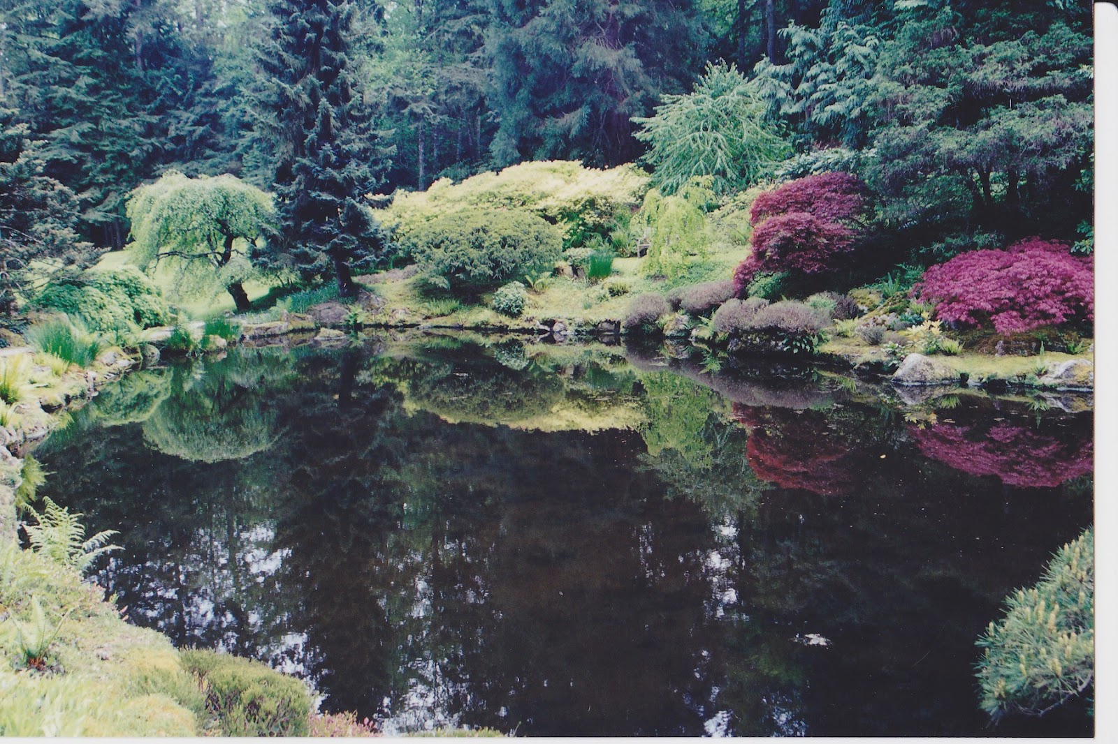
The Reflection pool with its glassy water surface is fed by springs
Next door, is the Moss Garden where a thick green carpet of Irish Moss solidly covers the ground, fallen trees and decaying stumps. Beyond, is the entrance to the Reflection Garden surrounded by a perimeter of neatly clipped English Yew hedges. In the center is the Reflection Pool, a 200’ rectangle fed by natural springs. Its glassy, still surface creates a mirror image of surrounding trees and greenery.
While the Reserve is spectacular in spring with its showy rhodos, azaleas, and wildflowers, October is one of the best times to visit. The colorful fall foliage displays are unparalleled in the Puget Sound area. Japanese maples turn a fiery red and orange, while aspens and tulip trees provide brilliant yellow tones. A Persian Parrot tree features leaves of yellow with red, orange, and purple highlights. The backdrop of dark evergreens enhances the whole fireworks show of bright, wild colors.
The Reserve is easily reached by driving north on I-5 from Olympia, and following US 101 and State Routes 3 and 305 through the Kitsap Peninsula. The park is on the northern tip of Bainbridge Island, just south of the Scandinavian town of Paulsbo. The Island is also accessible by regular ferry service from Seattle.

Sunday, May 20, 2012

Lakewold Gardens: In Search of the Blue Poppy


Himalayan Blue Poppy
The vivid color of its petals has been compared to the blue of Paul Newman’s eyes. Rare and difficult to grow, this flower has earned the reputation as the “elusive butterfly of the garden”. It is indigenous to the sub-Alpine meadows of the Himalayan Mountains in Bhutan, Tibet, China, and Nepal; but, no need to get out your passport or pack your bags to see this marvelous plant. The Himalayan Blue Poppy’s taste for cool, moist summers; shade; and acidic soil means the Pacific Northwest is one of the few places outside its native habitat where the plant can thrive. Lakewold Gardens Estate, just south of Tacoma, bills itself as the spot “Where the Blue Poppy Grows” and is the best place to admire this pretty perennial.

The gardens consist of ten acres of manicured grounds surrounding a Georgian-style mansion on the shores of Gravelly Lake. Considered one of America’s great estate gardens, Lakewold features large collections of Rhododendrons (250 different species), Japanese maples (30 varieties), camellias, and cherry trees along with several gardens within gardens, sweeping lawns, European-inspired parterres, reflecting pool, and gazebo.

Brick pathway connects home and gazebo
The property was first developed in the early 1900s as wealthy Tacomans established summer retreats along the shorelines of a series of lakes south of the city. H.F. and Ruth Alexander, owners of the Admiral Lines, inherited the land, added additional acreage, and enlisted designers to create a fabulous estate and gardens that would capture the views of Gravelly Lake and Mount Rainier. The Olmstead Brothers, known for their work in public parks of Seattle and Portland, are credited with designing the brick walkway, perimeter fence, and gate.

Reflecting Pool
In 1938, the estate was sold to George Croydon and Eulalie Wagner. He was an established Tacoma businessman with ties to timber and coal production and she was a daughter of the Merrill’s, a prominent Seattle lumber family. With her strong interest in gardening and the arts, she is largely responsible for the look of the garden today. She was an avid plant collector, and added a sizeable collection of choice and rare plants, including the blue poppy, to the grounds.

Thomas Church, a nationally recognized landscape architect, visited the property many times between the 1950s-1970s and greatly influenced the garden design including the pool and teahouse. His emphasis on multiple vantage points and a free flow between the house and garden are observable today.

Upon her death in 1987, Mrs. Wagner donated the property to the non-profit Friends of Lakewold so the gardens could be preserved, maintained, and enjoyed by the public.

Visiting Lakewold seems more like an excursion to someone’s private estate than a public garden. The self-guided tour begins along the Circle Drive leading to the house through a forest of tall rhododendron. The Wagner House, built in the Georgian revival style, is also open to the public and serves as a popular venue for weddings and meetings. Beyond the home’s glassed sun room, an intricate brick pathway leads to the gazebo, or tea house. On both sides, neatly trimmed boxwood hedges surround topiaries and create parterres, small patterned gardens. Next to the rose-covered gazebo is an unusual, decorative swimming pool designed by Thomas Church. He is also responsible for the medieval inspired Knot Garden, shaped like a ribbon bow and filled with culinary herbs. Other “gardens within gardens” include a rock garden, fern garden, woodland garden built below a giant Douglas fir, rose garden and waterfall.
Knot Garden

A special bonus is the Garden Shop located in the original 1918 carriage house. It offers a unique selection of gardening books, tools, seed packets, and many of the rare plants seen in the garden. The Himalayan Blue Poppy is also available here but only once a year and for a few weeks in the spring. Needless to say, the limited supply sells out quickly.

The month of May is an excellent time to visit Lakewold when the spring bloomers, including the rhododendron, are at their peak. In late May and early June, the blue poppy shows off its spectacular blossom. The garden is open Wednesday through Sunday from 10 am to 4 pm and admission is $9 for adults, $6 for seniors. To check if the poppies are in bloom, call 253-584-4106 or visit their web site, www.lakewoldgardens.org.

Saturday, April 14, 2012

Rattlesnake Grade: A Road to Remember

Oregon Highway 3 on its descent to the Grande Ronde River
On the map, Oregon Highway 3 and its continuation, Washington Highway 129, appear to be a direct shot across the upper right-hand corner of the state, connecting Enterprise, Ore. and Clarkston, Wash.  However, the reality of this road is quite different. Why else would the American Motorcycle Association designate it as one of the top 15 motorcycle rides in America? The 80-mile trip offers an enormous variety of scenery from snow-capped peaks, expansive canyons, pine forests, wide open wheat fields, a narrow river valley, ghost town, and enough twists and turns and plunging drop-offs to make a person dizzy. Fortunately, there is very little traffic.

Joseph Canyon Overlook
Traveling from south to north, the drive begins in Enterprise, the county seat of Wallowa County and, more important, home to the last gas stations for the next 65 miles. The road heads north through rolling prairie and ranch land with spectacular views of the Wallowa Mountains receding in the rearview mirror. Elevation gain transforms the scenery to pine forests, and around 30 miles from Enterprise is the Joseph Canyon Overlook. From here, the view spreads out forever across a network of steep canyons. The Nez Perce called the area Saqanma, meaning long, rough canyon, and made their winter camp here at the confluence of Joseph Creek and the Grande Ronde River in the protected canyon’s bottom.

To savor this remarkable panorama, continue a few miles north to the Rim Rock Inn, a restaurant offering indoor and outdoor dining with a million dollar view. Who would expect to find a turkey panini sandwich with sun-dried tomatoes here in the absolute middle of nowhere! A former stagecoach stop, the inn now has four tepees available for rent for adventurous types wanting to spend the night right on the canyon edge.
Flora Methodist Church

Beyond the inn is a road turning west marked “Flora” and well worth the six mile, roundtrip detour to this once thriving farming and ranch community.  Platted in 1897, the town was named for the daughter of the first postmaster and grew to a population of 320 by 1910 with a bank, general store, and newspaper. The Methodist Episcopal Church was constructed in 1898 and an impressive, 8-room school house added to serve the rural community in 1915. However, the area’s isolation and the economic realities of the family farm contributed to the town’s demise and by 1966 the post office closed, followed by the school in 1977.  Today, the town (population 7) consists of a dozen or so abandoned houses and buildings, an overgrown cemetery, and an endless supply of photo opportunities. The church and school with its striking bell tower stand next to each other on the north side of town, dominating the landscape. The school has recently been restored with the idea of converting it to a center for pioneer arts and crafts.

Flora School
Back on Oregon 3, just beyond Buford Ridge Road, look for a pull-off on the left side of the road.  Here is the first, and probably the best, glimpse of the road ahead and explains why it is so popular with motorcyclists. Layer after layer of barren canyon opens up exposing the highway as it snakes its way down to the Grande Ronde River. About half way down, a sign proclaims, Welcome to Washington, The Evergreen State. Of course, in the late summer and early fall the scenery is shades of brown without a tree in sight. At the bridge over the river is a welcome token of civilization, Boggan’s Oasis.  Along the banks of the river, it promises the world’s best milk shakes, tasty burgers, overnight cabins, good fishing, and a swimming hole. It’s an excellent place to freshen up before tackling the next challenge, the ten mile, twisty ascent to the top of Rattlesnake Pass. This is a workout for a car and it seems almost unbelievable that several thousand participants in the 2010 Cycle Oregon tour made this trek on bicycles!

Beyond the pass, the route opens up into a broad plateau, skirts the small farming community of Anatone before one last thrilling corkscrew descent into the town of Asotin on the banks of the mighty Snake River. If the drive was not sufficiently thrilling, consider continuing on across the river to Clarkston. Here, several outfitters offer trips down the scenic Snake River through Hell’s Canyon, the deepest gorge in North America. A smorgasbord of options including full day trips, half days, overnight stays deep in the canyon, and wine and dinner cruises. 

More photos:


Boggan's Oasis, a popular stop for cyclists